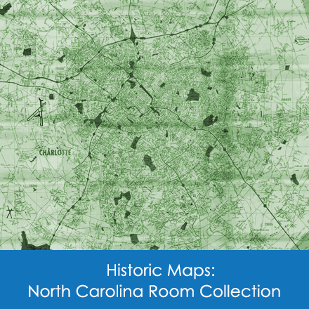
You are here
Early Settlers
IN America there were centuries of frontiers. The Piedmont frontier of the Carolinas was first described by an explorer sent out, in 1670, by Governor Berkeley of Virginia. To this traveler, John Lederer, belongs the credit for opening the trading path used later by the colonists of Virginia for trading with the Indians of the Carolinas. Originally known as the Occoneechee Trail, the Catawba Trading Path became, in the first phase of exploration and settlement, the most important route through the Piedmont.
The best available information indicates that the Catawba Trading Path had its southern terminus near the present town of Concord. Successive traders opened two branches from there, one of which led to the Catawba Indian domain on the Catawba River, a few miles beyond the present site of Charlotte. The other branch went almost directly south through Waxhaw and on into South Carolina. In the early nineteenth century minor trails began to radiate from the point where Charlotte now stands, eastward to the coast of North Carolina, southward to the Charleston area and westward to where, a few miles away, iron ore had been discovered. At the confluence of these branching highways, the city of Charlotte grew. To the gold that was discovered in Mecklenburg and surrounding counties, Charlotte owes its economic stability during the first half of the nineteenth century. To the railroads, and later to the highways which followed the original pattern by converging at Charlotte, the city owes its commercial prestige.
When Lederer directed the second of his three trips in America to the Piedmont area, the Catawbas had advanced to the point of maintaining settlements with crude housing facilities and some cleared ground for agricultural purposes. They were no longer alarmed nor surprised by the occasional appearance of white men, since many members of the tribe had drifted southward from the more populous north during the previous generation. Except for marauding groups from hostile tribes, which now and ten terrorized colonists during the 1740's, 1750's and 1760's, the only Indians in Mecklenburg county were the Catawbas.
They were members of an important tribe of Siouan stock of the north. The name Catawba is probably derived from the Choctaw word meaning "divided" or "separated." In 1763, following alternating periods of peace and contention over real or fancied grievances on the part of both white men and Indians, an agreement was reached whereby the white men set aside an area about fifteen miles square for the use of the Catawbas. By this time the tribe had been diminished through conflict and disease from about five thousand in 1700 to less than one thousand.
The territory allotted the Indians was on the Catawba River extending into South Carolina and with the northern boundary only a few miles from the Charlotte city limit. This reservation is shown on the maps of those days as "Indian Nation" or "Catawba Nation." From time to time the size of the reservation was reduced, and in 1950 it was composed of only a few hundred acres, nine miles south of Rock Hill, South Carolina, where about 600 members of the tribe in some 162 families made their homes.
In the summer of 1959 a number of Catawbas pushed through the United States Congress a bill allowing division of the tribal assets if a majority of the individual Indians voted for such a move. While there was some opposition, a majority for this division and the Secretary of Interior declared on June 30, 1960, that no Indian child born after midnight July 2, 1960, would be officially termed an Indian. Thus the tribal rolls were closed forever and the Catawba nation, last organized Indian tribe in South Carolina, ceased to exist.
Authoritative information about the history of the Catawba Indian tribe can be found in the book, A City Without Cobwebs, by Douglas Summers Brown (1953).
"The Lost Nation," as the Catawba Indians are sometimes described, gave way to a race of sturdy pioneers, and within twenty-five years of the arrival of the first white settlers, their numbers greatly diminished. The first such settlers were Pennsylvanians, members of the Spratt family, who arrived in the 1740's. Thomas Polk is reported to have followed these pioneers for love of Spratt's daughter, whom he subsequently married. It was the grand-nephew of this couple, James Knox Polk, who became eleventh President of the United States.
Immigrants who followed the Spratts and Polk to Mecklenburg County came from three principle sources. The largest group, the so-called Scotch-Irish, became most influential in establishing the area's culture. They rolled southward from western Pennsylvania and Virginia.
The Scotch-Irish were followed by Germans who had first settled in Pennsylvania. This group located mostly in present day Cabarrus, Lincoln, and Gaston counties. About the same time there were many arrivals from lower South Carolina who found the low country too great a contrast to their native England, Scotland, Germany, and France.
So great was the numerical superiority of the Scotch-Irish, coupled with their traditional religious fervor, that they were instrumental in organizing the first seven churches to be established in Mecklenburg. The spirit of the people who built them is, perhaps, the most significant feature to be found in the historical records of Charlotte and Mecklenburg, and has greatly influenced the lives of each succeeding generation.
Living conditions in early Mecklenburg were harsh, inconceivably so to people of the mid-twentieth century. The isolation of each family, the tiny homesites buried in almost unbroken seas of forest, helped to mold a self-reliant and sturdy people. Hardship and scarcity were their intimate companions.
All examples of early colonial architecture in Mecklenburg have long since vanished. A few homes built during the Revolutionary period and shortly thereafter still remain. Among these, one of the best known is the Hezekiah Alexander house, built in 1774. This house is built of fieldstone and is two stories in height and almost square. It is on property owned by the Methodist Home of Charlotte, but leased for ninety-nine years to the Mecklenburg Council, Daughters of the American Revolution. It contains many relics of the colonial period of American history, is kept in good condition and opened occasionally for public inspection.
The most admired early home still standing in this section is the Craighead Davidson home, built by Archibald Frew in 1780. This is a white frame house on North Tryon Street, surrounded by a well-known lawn, attractive garden flowers, trees and boxwoods. It has been occupied for many years by the family of Mr. and Mrs. Craighead Davidson and is now maintained as the home of their daughters, the Misses Mary Louise and Alice Davidson. These and other examples of early architecture to be found in the Mecklenburg area are described by James Stenhouse in his Exploring Old Mecklenburg (1954).
By 1760 the population of Mecklenburg was well, if sparsely, distributed and the establishment of Mecklenburg as a separate county took place in 1762. Once the county was established the necessity for selecting a county seat became a problem.
Residents of the Rocky River community sought to have the county seat in that section and, toward this end, had a bill introduced in the legislature. Citizens living nearer the spot variously named on old maps as "Charlotteburg" and "Charlottetown" hastily constructed a log structure which they designated as a courthouse, as an inducement to having their village made the county seat. In 1768 Charlotte was named "temporary county seat for 7 years," and in March 1774, it became the permanent county seat.
Charlotte began its corporate being on November 7, 1768, occupying a plot of 360 acres. This property had been deeded by Henry E. McCullough, agent for Lord George Augustus Selwyn, to Abraham Alexander, Thomas Polk and John Frohock as "trustees and directors aforesaid of a town, etc."
As their first official act, the trustees of the town laid out 100 of the original 360 acres into half-acre lots, sale of eighty of which had already been arranged. Roughly, the 100-acre plot which furnished the nucleus for Charlotte was bounded on the north by present-day Fifth Street, on the south by Fourth Street, on the east by College Street, and on the west by Church Street.
The usual house among the first built in Charlotte was built of sawed or hewn logs with cracks filled with mud or straw. There would be a large room about twenty feet square with a high roof and one or two bedroom areas partitioned with curtains or planks. Light came from only one window in each room. The common chimney was made of stone, though a few better ones were made of brick, and the roof was clapboard fastened with home-made nails.
Blythe, LeGette and Brockmann, Charles Raven. Hornets' Nest: The Story of Charlotte and Mecklenburg County. Charlotte, NC: Public Library of Charlotte and Mecklenburg County, 1961.